|
Fairfield
Horseshoe
Starting point and OS Grid reference:

Car
park on the north side of Ambleside (NY 376047)
|
Ordnance Survey Map
OL5
The English Lakes - North Eastern Area and OL7 The English Lakes – South
Eastern Area.
Buy these maps from
List
of OS Maps
Commission from map sales is
used to fund the website, so keeping it free to use.
| |
Distance: 10.5 miles
|
Date of Walk: 6
January 2011
| |
Ascent:
Descent:
See Walking Time Calculator
|
1039m (3408ft)
1038m (3409ft)
| |
Traffic
light rating:
 
(For explanation see My
Walks page)
| |


For advice on .gpx files see
My Walks page
|

Click
the PDF logo above to give a printable version of this walk without the
photos.
|
To
view route as a dynamic Ordnance Survey map click here.
Introduction: This is a strenuous walk but one which is
mostly an easy to route find, providing you have good visibility. Gaiters
are recommended for the descent which can be boggy in places. To fully cover
the route at 1:25000, you need the two OS maps listed above.
Start: The walk starts in the main car-park at
Ambleside, opposite The Armitt Museum (NY 376047). To use this car park, you
may need a second mortgage and a plentiful supply of pound coins! It is a
waste of time trying to economise by trying to find free parking in the
town. There is none - the Council have things sewn up.
Ambleside is on the A591 between Kendal
and Keswick. The exorbitant car park is on A591 at the north west edge of
the town.
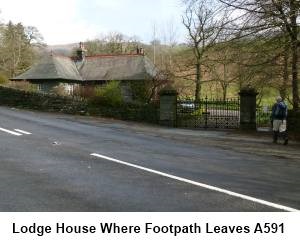
To begin the walk, turn left out of the car
park and walk along the A591 for about 1/3 of a mile. Shortly after you pass
the national speed limit sign, look out on the right for a bungalow/lodgehouse
behind some substantial stone gateposts with iron gates (NY 372052). There
is a fingerpost here indicating Public
Footpath to Rydal Hall but it is not easy to spot and probably disappears
into the shrubbery in spring/summer.
Go through the small gate and follow the
track alongside the brook. After a few hundred yards, the track swings away
from the brook. Stay on the track going through the gate (or over stile)
into the grounds of Rydale Hall. Turn right at the finger post for Nab Scar.
Go left through the Rydal Hall buildings and over the bridge following the
Grasmere/Rydal Mount signs.
On arriving at the metalled lane (NY 365064),
turn right signposted Nab Scar. The lane climbs and past the bus turning
point, turn right along a concreted track. As this track curves left, carry
straight on through the kissing gate heading for the fell (NY 364065).
Beyond the kissing gate the path has been well “manicured” with stone
steps. The path passes between two walls and leads to a ladder stile. Beyond
this you come out on to the fell proper.
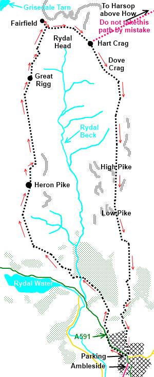
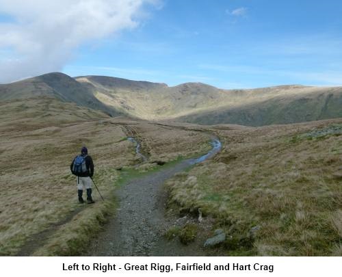
The walk is now something of a relentless
climb for the next 3.5 miles along the ridge to the summit of Fairfield,
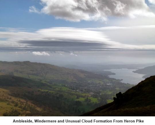
passing over Nab Scar (NY 360068), Heron Pike (NY 356083) and Great Rigg (NY
356105). Just keep climbing and ignore any tracks which lead off the ridge
top. There are good views of the Langdale Pikes and the major Lake district
fells to the west, as well as down to Rydal Water and Grasmere.
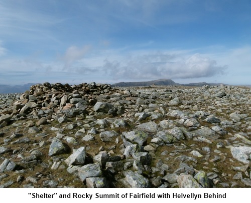
The arrival at the summit (NY 358117) is
something of an anticlimax. There is no trig point or summit cairn of note
(only a very small cairn). You are faced with a flat stony top and some
crude attempts at shelters. The bonus however is a fantastic view of
Dollywaggon Pike, Nethermost Pike and Helvellyn with the contours of
Striding Edge clearly visible. It is worth wandering to the north west edge
of the Fairfield plateau for the best views but do not descend too far.
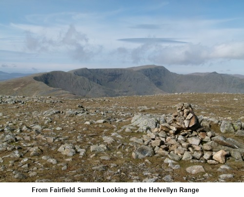
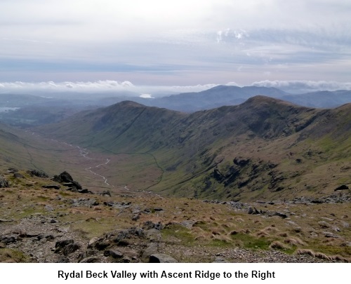
The walk now continues across Fairfield
across the head of the Rydal Beck valley. If you are lucky, you might see
clouds forming from no-where as the winds sweep up and over the edge. The
path is in an easterly direction first then south east towards Hart Crag.
This is potentially where you could go wrong
so concentrate!
You make the descent from the Fairfield
plateau then climb Hart Crag. At the top of Hart Crag (NY 3681143), the path
levels out and there is a large stone cairn (pile of stones). The obvious
path begins to descend from the cairn but you do not want this as it
leads to Hartsop above How and ultimately to Patterdale. From the cairn, you
need to bear right. The path is not east to see because of the stony ground.
The compass bearing from the cairn is 140 degrees (discounting adjustments
for magnetic variation).
The path soon becomes clearer. The descent
from Hart Crag is rocky and a
little tricky but you just need to watch where you put your feet.
The path soon starts to run alongside a stone
wall, at first collapsed but later more complete. This wall is your guiding
hand virtually all the way back to Ambleside. The OS map shows the main
footpath route changing to the right (west) of the wall but I found it
easier to stick to the left side – a dotted path is shown on the OS map.
You cross High Pike (NY 374088) and Low Pike
(NY 374078).
Other than where the terrain forces minor
detours, stick to the wall all the way down. It runs out at a wooded valley
overlooking Scandale Beck (NY 376057). Turn right through the gate and
follow the track down into Ambleside. It becomes a metalled road which
brings you out opposite the car park where you started.
If
you need to buy any hiking equipment/clothing before your trip see the Hiking
Store
Before
venturing on to the Lake District fells, for your own safety, please check
the Fell
Top Conditions
All information on this
site is given in good faith and no liability is accepted in respect of any
damage, loss or injury which might result from acting on it.
|


.jpg)
.jpg)
.jpg)