|
Arncliffe
to Kettlewell
Starting point and OS Grid reference: 
Arncliffe
village centre (SD 931719)
|
Ordnance Survey Map
OL 30 Yorkshire Dales - Northern and Central
areas.
Buy this map from
List
of OS Maps
Commission from map sales is
used to fund the website, so keeping it free to use.
| |
Distance: 7.25
miles
|
Date of Walk: 24 February 2011
| |
Ascent:
Descent:
See Walking Time Calculator
|
2003ft (611m)
2004ft (611m)
| |
Traffic
light rating: 

(For explanation see My
Walks page)
| |


For advice on .gpx files see
My Walks page
|

Click
the PDF logo above to give a printable version of this walk without the
photos.
|
To
view route as a dynamic Ordnance Survey map click here.
This walk is now available as a Kindle book.
Click the symbol for further details

Introduction: This walk only
just earns red rather than amber traffic lights due to the fairly
steep ascents and descents. You actually do over 2000 feet of
climbing/descending overall.
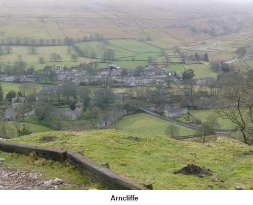
This walk starts in the picturesque Yorkshire
Dales village of Arncliffe, made famous in the early days of the TV series
Emmerdale when its pub the Falcon Inn was used as a film set. Unfortunately,
it hardly ever seems to be open! To get there, drive up Wharfedale through
Threshfield and Kilnsey then take the next left to enter pretty Littondale.
Arncliffe is the first village. Park in the village centre.
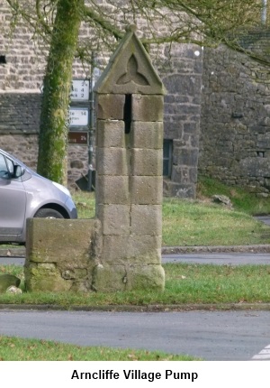
Start: The walk starts from the old village pump.
Head north from the pump and take the narrow lane between the cottages.
Follow this over the river bridge (River Skirfare). At the ‘T’ junction
( SD 932721) facing you is a gated stile leading into a field and a finger
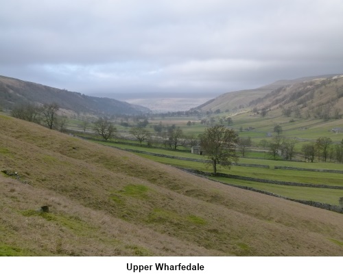
post indicating “Starbotton”. A fairly lung bursting climb then takes
you up the field following the wall to the right. Follow the wall round to
the right and the path becomes a broad track.
Stay on the track and through a gateway with
a metal gate, it opens out on to the heather covered moor. At the crest of
the hill, go through a small gate and the path starts to descend.
Part way down the hill, pass through another
gateway by a three-way fingerpost and the hamlet of Starbotton is below you.
Turn left. The path descends a stony path through trees, eventually becoming
a narrow walled track which turns right by a ruined barn. Follow the track
down to the river by a footbridge (SD 951745). Do not cross it but turn
right following the direction of the fingerpost to Kettlewell.
The footpath becomes a walled lane for a
short distance and after crossing over a stream, go through the kissing gate
on the left. Stay on the walled track and follow the course of the river
emerging by the road bridge just southwest of Kettlewell. Turn right.
If you want refreshments, Kettlewell has
several choices including three pubs (a personal favourite is the Kings
Head). If you prefer to munch your own sandwiches, there is a bench just by
the road bridge or if you walk into Kettlewell, there is a choice of benches
by the maypole. Kettlewell is famous for its scarecrow festival. See the
village website for details (http://www.kettlewell.info).
Public toilets are available in the car park.I
Immediately after crossing the road bridge
(with Kettlewell behind you) turn right up a broad cobbled track. A finger
post reads “Bridlepath Moor End, Footpath Arncliffe.
A few yards further on take the track on the
left heading steeply uphill signposted Arncliffe. At a fork, take the left
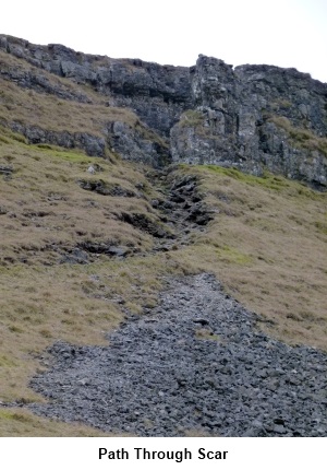
branch indicated by a wooden post with a green line around it. Head for the
gap in the scar (SD 964723) through which the path passes and climb to the
hilltop.
The path descends and going through some trees the path is a little
awkward, steep and the limestone can be slippery.
At the road, cross straight over, cross a
stone stile and follow the river back to the road. Back over the river
bridge into Arncliffe.
If
you need to buy any hiking equipment/clothing before your trip see the Hiking
Store
All information on this
site is given in good faith and no liability is accepted in respect of any
damage, loss or injury which might result from acting on it.
|


.jpg)
.jpg)
.jpg)