|
Whernside
Starting point and OS Grid reference:

Lay-by
parking area just yards north of where the B6479 meets the B6255 (SD
766793) at Ribblehead.
|
Ordnance Survey Map
OL2
Yorkshire Dales - Southern & Western Areas.
Buy
this map from
List
of OS Maps
Commission
from map sales is used to fund the website, so keeping it free to use.
| |
Distance: 8 Miles
|
Date of Walk: 22 August 2007
| |
Ascent:
Descent:
See Walking Time Calculator
|
489m (1604ft)
489m (1604ft)
| |
Traffic
light rating: 


(For explanation see My
Walks page)
| |


For advice on .gpx files see
My Walks page
|

Click
the PDF logo above to give a printable version of this walk without the
photos.
|
To
view route as a dynamic Ordnance Survey map click here.
Introduction:
Despite being
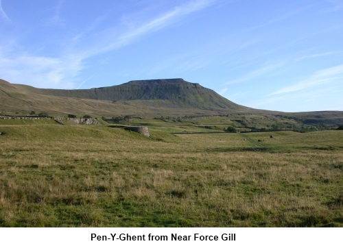
one of the “Three Peaks”, Whernside does not get the same attention.
True it lacks the dramatic profiles of its sisters Pen-y-Ghent and
Ingleborough and has a relatively boring “whaleback” profile. Yet, it is
the highest of the Three being 736 metres (2415ft) high against Pen-y-Ghent
(694m – 2277ft) and Ingleborough
(723m - 2372). By some quirk of Yorkshire logic, it is also higher than the
more grandly named “Great Whernside” near Kettlewell which only manages
a paltry 704 metres. It is the only one to have tarns at its higher levels
and it gives you the chance to get up close and personal to that masterpiece
of Victorian engineering, the Ribblehead railway viaduct. The views from the
summit are also magnificent.
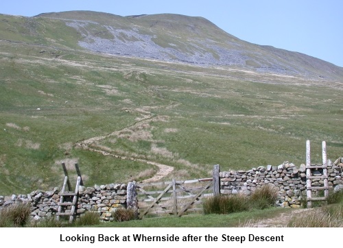
In my view,
the descent is rather harder work than the ascent (on the knees!) hence the
order of the traffic lights.
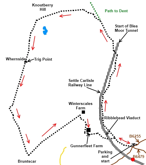
Start:
Our walk
starts at Ribblehead from a parking area just yards north of where the B6479 meets the B6255
(SD 766793). The B6255 is the road which runs from the A65 at Ingleton to
the A684 at Hawes.
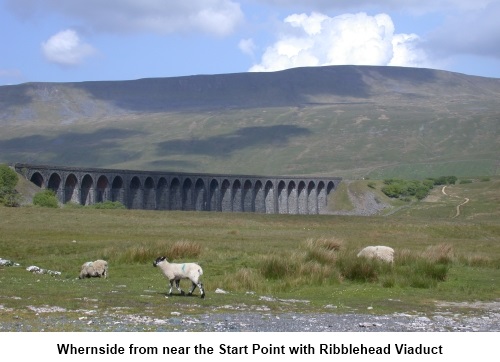
Take the
obvious track heading towards the Ribblehead Viaduct but do not pass under
it. Instead, follow the path which follows the Settle Carlisle railway
tracks keeping them on your left. Keeping as close as the path allows to the
tracks, remain on it for about two miles until an
aqueduct
bridge takes you
across the tracks close to and giving a great view of the railway tunnel
under Blea Moor (SD 761816).
This
tunnel is the longest on the Settle Carlisle railway being 2629 yards long.
It opened in 1876 and is still going strong.
Once across
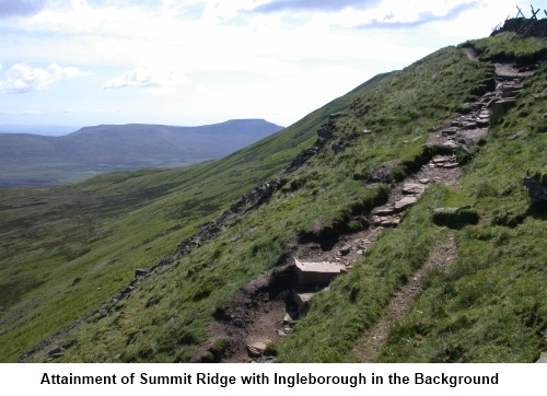
the bridge, the path climbs. Take the left fork when the path divides and
gradually swing round in an arc with a wall to your right cresting the ridge
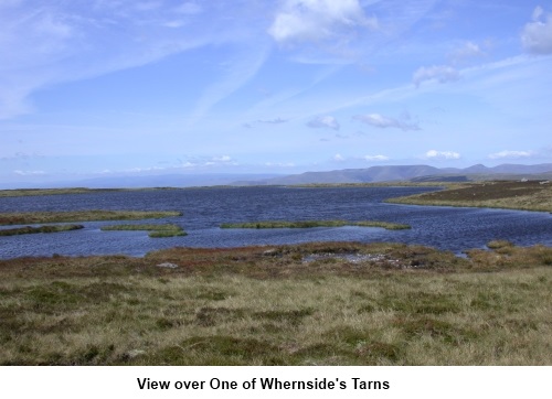
at SD 741824.Whernside tarns are
to your right and an unnamed tarn to the left. Turn left to walk along the
long ridge keeping the stone wall on your right arriving at the trig point
(SD 739814) through a narrow stile. There is a wall shelter here for lunch.
If the weather is clear, there will be great views towards the Howgills and
the Lake District and in the other direction Pen-y-Ghent and Ingleborough.
Return to the
east side of the wall and follow the path in a southerly direction. After ¾
of a mile, the path swings away south eastwards (SD 735803) just below High
Pike.
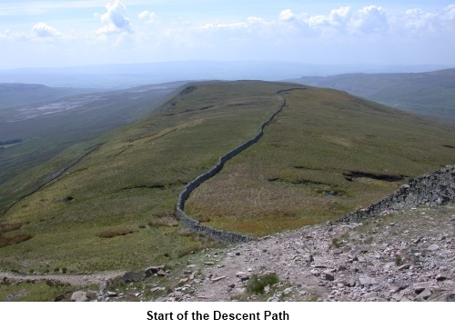
Descending
the steep path, you cross three walls then turn left (SD 739791) heading for
the farm at Ivescar. The path becomes a broader track heading towards the
railway viaduct. Just before
Winterscales farm, turn right through a gate.
Turn left
past Gunnerfleet Farm (SD 753796) and follow the obvious track to pass under
the viaduct and marvel at how they managed to build this in the 1870s!
The return to
the car is now clear.
This walk can
be accessed from the station at Ribblehead should you wish to avoid using a
car and the station building houses an interesting collection of railway
memorabilia.
If
you need to buy any hiking equipment/clothing before your trip see the Hiking
Store
All information on this
site is given in good faith and no liability is accepted in respect of any
damage, loss or injury which might result from acting on it.
|


.jpg)
.jpg)
.jpg)