|
Bolberry
and Hope Cove
|
Starting
point and OS Grid reference:

National
Trust car park at Bolberry Down (SX689385)
|
Ordnance
Survey Map
OL20
- South Devon Brixham to Newton Ferrers.
Buy this map from
List
of OS Maps
Note: If you use OS Maps on-line, you can download this route via this
link.
| |
Distance: 6.7
miles
| |
Traffic light rating:

(For explanation see My
Walks page)
| |


For advice on .gpx files see
My
Walks page
|

Click
the PDF logo above to give a printable version of this walk without the
photos.
|
To
view route as a dynamic Ordnance Survey map click here.
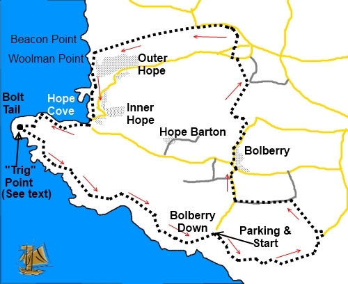
Inrtoduction: This walk takes you around the spectacular
coastal scenery of Bolt Tail with long distance views and includes the
picturesque village of Hope Cove (technically two – Inner Hope and Outer
Hope), with its harbour and nice beach. Refreshment can be had at the Hope
and Anchor - which is open all day and the Sun Bay Hotel. The walk takes in
some lovely by-ways and where there is road walking, this is kept to a
minimum on very quiet lanes. In spring, the hedgerows are a plethora of wild
flowers.
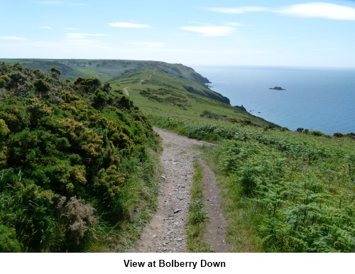
Start: The walk starts at the National Trust (NT)
car park (honesty box) at Bolberry Down. To get there, turn off the
Kingsbridge to Salcombe roar (A381) into Malborough (just before the
garage). Wend your way through its narrow street and follow the road signs
for Bolberry then Bolberry Down.
At the NT car park (SX689385),facing
the sea, turn left and follow the coastal footpath. At the first footpath
post after a gate, turn left (inland) along a path indicated with a green
arrow (SX 691382). You enter the NT land of South Devon Farm.
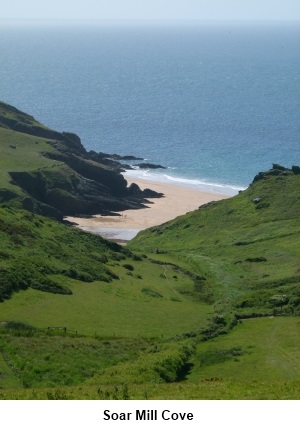
Walk
past the rocky outcrop on the left and follow the broad track down the hill
alongside the remains of an ancient wall of large upright stones. There is a
good view to Soar Mill Cove which we will visit on another walk. Bear left
until you come to a fingerpost. Take the path indicated as Malborough 1½
miles. After passing through a gate, the track becomes walled for a short
distance.
Pass between the buildings of South Down Farm
and immediately after passing the car parking area for the farm, turn left
at a fingerpost designating
“Public Footpath” (SX700385). Follow the yellow footpath arrows
past the NT workshop and on to a tarmac lane. Turn left and almost
immediately right at another fingerpost.
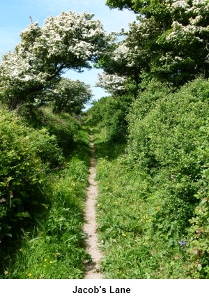
The village of Malborough with its church
spire becomes clearly visible as you cross the field. The path emerges into
another footpath at a ‘T’ junction of paths (SX 697389). This path lined
with hedges is called Jacob’s Lane. Turn left following the fingerpost for
“Bolberry Down ¾ ”.
Jacob’s Lane exits into the road along
which you went to Bolberry Down. Turn right down the hill to a road junction
then left where the road sign shows Hope Cove 1¼ miles.
At the next fork in the road, go right. The
road dips past a thatched cottage on the right then climbs. Where it bends
sharply right, look out for the fingerpost on the left (SX 692396)
indicating “Sweethearts’ Lane” and “Galmpton ½ mile”. Follow
Sweethearts’ Lane to a broad track in front of an imposing stone house and
turn left. About 100 yards further on, turn right where the fingerpost
indicated Galmpton ¾ mile (I cannot account for the disparity in the
distances to Galmpton!).
The path climbs up the field and over the
stile, turn right as indicated by the footpath arrow. Through the next
gateway is a crossroads of footpaths (SX 691400)where, should you wish to
shorten the walk for any reason, you can turn left to Inner Hope and the
coastal path. Otherwise, keep straight ahead and follow the track down the
hill but turn left at a gateway above a pond (SX 692401). Go down the field
bearing left to a stile at the bottom and once there, follow the footpath
arrow bearing right to a ‘V’ shaped wooden stile in the corner of the
field.
At the next stile, go straight ahead on the
tarmac path between the houses and along the road to the junction. Turn left
and at a stone built barn on the left, turn right where there is a
fingerpost. Where the broad track swings right, carry straight ahead on a
narrow footpath.
At the next road, turn right and very quickly
turn left into what at first glance looks like a private drive to garages.
Close to the garages, on the right, a fingerpost indicates the way over a
stile. Cross the field diagonally bearing right and as you reach the crest
you will see a stile. Cross this into the lane and turn left.
Follow the lane for about half a mile. Where
it bends sharp right, your route continues straight ahead along Beacon Lane
SX 687408). The finger post indicates “Footpath Link to Coastal Path.
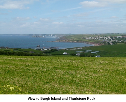
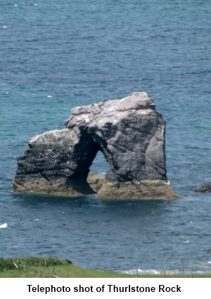
There are good views here of Burgh Island and Thurlstone Rock (with the
hole).
On reaching the coastal path, turn left and
follow it to Outer Hope.
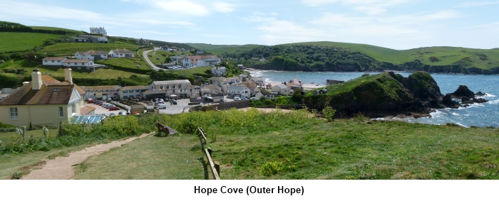
From Outer Hope, the route continues along a
tarmac climbing path behind the harbour which has good views of the village.
This soon descends to Inner Hope at the Sun Bay Hotel. Turn right and follow
the road behind the beach until just past the slipway on the right, a
fingerpost indicates a continuation of the coastal path and Salcombe 7½
miles. Before making this turn, you might like to walk a hundred yards or so
along the road to see the picturesque thatched cottages in a cul-de-sac on
the right.
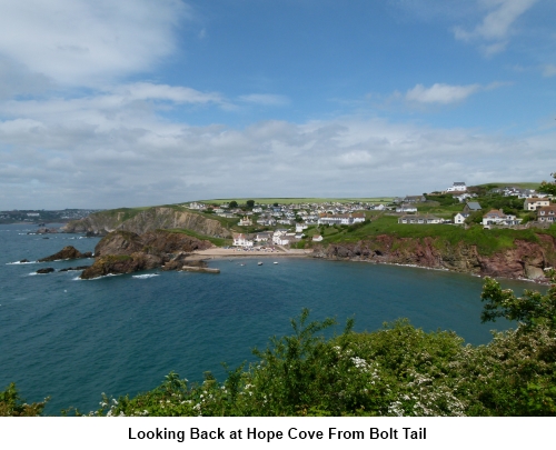
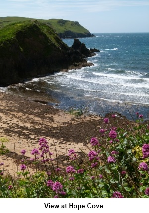
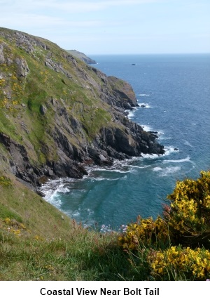
Back on the route, you now enter NT land at
Bolt Tail with great views back to Hope Cove and along the coast. On
reaching the footpath post at the top of the hill for “Bolt Tail”, go
right for the viewpoint. Continue on the path round Botl Tail and where it
forks keep right.
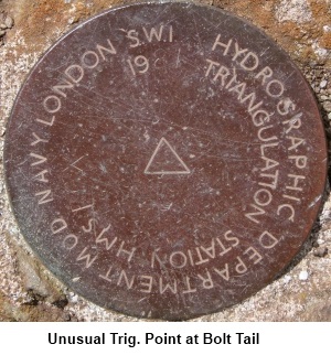
Find the unusual small round plate marking a
“Trig. Point” then just continue along the coast back to your starting
point.
If
you need to buy any hiking equipment/clothing before your trip see the Hiking
Store
All information on this
site is given in good faith and no liability is accepted in respect of any
damage, loss or injury which might result from acting on it.
|


.jpg)
.jpg)
.jpg)