|
Salcombe
to Blanksmill Bridge and Snapes Point
|
Starting
point and OS Grid reference:

Salcombe
Shadycombe car park (pay and display) (SX
738392)
|
Ordnance
Survey Map
OL20
South Devon – Brixham to Newton Ferrers.
Buy this map from
List
of OS Maps
Note: If you use OS Maps on-line, you can download this route via this
link.
| |
Distance: 6.1 miles
| |
Traffic light rating:

(For explanation see My
Walks page)
| |


For advice on .gpx files see
My
Walks page
|

Click
the PDF logo above to give a printable version of this walk without the
photos.
|
To
view route as a dynamic Ordnance Survey map click here.
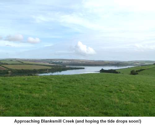
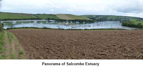
Introduction: This
interesting walk from Salcombe is described as a circular walk but the
section along the foreshore of Blanksmill Creek to Lincombe can only be
completed during a couple of hours either side of low tide so check tide
times – I was a bit early so had to wait! You need to be prepared to get a
little muddy along the water’s edge and good waterproof boots are
recommended.
There
is a good chance of seeing a variety of birds including herons, little
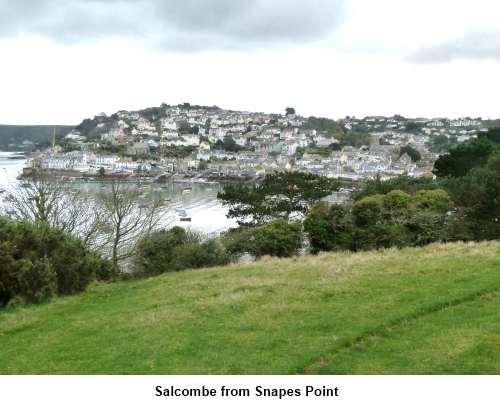
egrets and kingfishers. The view of Salcombe from above Snapes Point is one
of the best you could get.
If
low water is at the wrong time for you, you can still enjoy the Snapes Point
view by taking a shorter route as described below.
The
route is described from Salcombe. To get to Salcombe, take the A381 out of
Kingsbridge and keep going! There are two potential pay and display car
parks in Salcombe. One is on Shadycombe Road which you pass on your way to
the other at Gould Road. There is another on Fore Street but it is tiny,
your chances of getting a space there infinitesimal and by then you will be
in the one way system and past all central car parks. There is free street
parking on Devon Road. A copy of the street map is attached to the PDF
document.
The
car park at Shadycombe Road is taken as the start point.
The
walk can also be started from the National Trust car park at Lincome Cross
(SX 379402) – “honesty” box. This shortens the walk by a mile
or two but this would be a shame as it would then miss out the lovely walk
along Batson Creek to the equally picturesque hamlet of Batson itself.
Start: Exit the car
park on to Shadycombe Road (SX 738392). Turn right then right again and drop
down to the junction of Island Street and Gould Road. Bear left and walk
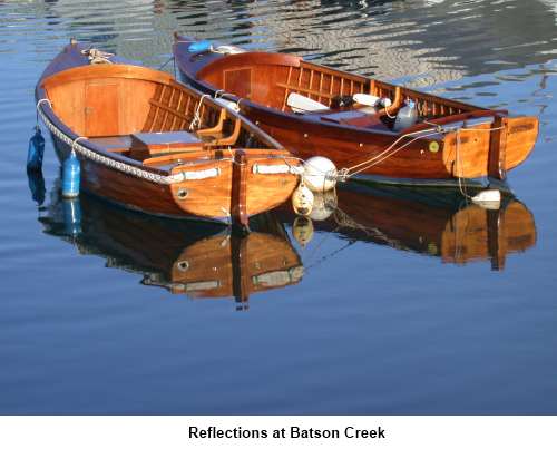
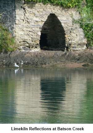
along the water’s edge, past the car park and boat storage area and
continue along the edge of Batson Creek to the hamlet, where the creek ends
(SX 735397). As you walk, notice the old limekiln across the water and
another by the road as you approach Batson.
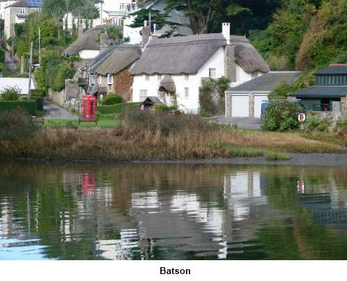
Take
the road from the right hand side of the hamlet and follow the road uphill
past the thatched cottages for about half a mile to the ‘T’ junction.
Turn left signposted for Marlborough 11/2 miles.
If
you have been unable to time this walk to coincide with low water, turn
right here for Lincombe Boatyard and Snapes Point and pick up the walk where
indicated below.
Assuming
you are going for the full walk, continue along the road to Horsecombe Cross
(written vertically on the road sign post) (SX 728401). Take the footpath
indicated by the fingerpost from the cross roads and walk down the left hand
side of the field.
Cross
the stile at the bottom and in the next field, cross diagonally right to the
gate at the bottom. Go through that gate and a second on to the track behind
Ilton Castle Farm. A footpath marker post with a yellow arrow indicates your
route to the right.
After
about 100 yards, turn left over a ‘V’ shaped stile, once again indicated
by a yellow footpath arrow and cross the little bridge straight ahead. Go
across the next field to the walkers’ gate and once through it, follow the
left hand boundary of the next field to a stile, cross over it and turn
right.
Follow
the well marked path along the next two fields and on coming out at the
narrow tarmac lane, turn right.
You
are quickly at Blanksmill Bridge (SX 727410) but immediately before reaching
it, turn right to follow the edge of the creek. You follow the foreshore of
Blanksmill Creek for 11/3 miles
until you get to the boatyard at Lincombe.
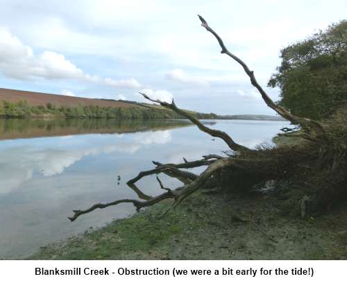
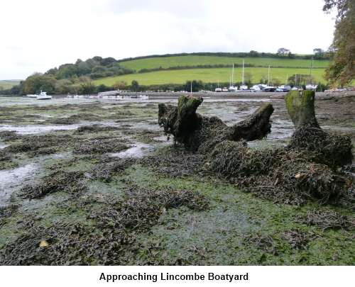
As you get to the
boatyard, look out for a shallow ditch on the right. The exact route of the
Right of Way here is none too clear initially.
Please note the
boatyard specifically ask that walkers do not cross the boatyard itself due
to the potentially dangerous working environment with 60T cranes and plant
operating.
Follow the ditch
along the right hand edge of the boatyard. As you get to the end of the
ditch, a footpath goes off to the right just before the concreted area.
Follow the path to
a walkers’ gate and through this, go straight ahead following the right
hand boundary, along a slight banking.
Go through another
walkers’ gate into a field with an old barn. Head left to a five bar gate
which takes you on to the tarmac lane.
Look out for a
National Trust sign indicating Snapes Point and go through the walkers’
gate (SX 741405).
[If you have had to
do the short walk because of the tide, pick up the route here.]
Climb
the steep path away from the lane following the right hand boundary of the
next two fields and at the top turn left following the fingerpost for
“Snapes Point”.
Follow
this large field round its left hand boundary until you get to a walkers’
gate in the corner. Through this and also follow the next field round its
left hand side rounding Tosnos Point.
Follow the obvious
path as it contours round the hill. When the path splits (see next paragraph
also), you have the choice of dropping down to the trees and following them
along to a gate in the corner of the field (which you may have to climb over
if locked) then turning right along a rough lane. However, if you turn left
after the gate, you reach some steps which take you to a nice spot
overlooking the water. Walk back along the lane.
Alternatively,
when the path splits, stick to the contour level and keeping to the right
hand path, which takes you to a fantastic viewpoint overlooking Salcombe (SX
745393).
After admiring the
view, continue to contour round the hill and you will see to your left
through the hedge the lane referred to above. Eventually, you come to a
walkers’ gate on the left where you join this lane. Turn right.
Whichever way you
chose, you end up on this lane. Follow it along and look out for a path on
the left with a fingerpost indicating the route to Batson (SX 743400).
Follow this down, turning right at a corned in a rather convoluted route to
avoid Snapes Manor, and eventually reaching a lane, where you turn right for
Batson, then left around the end of the creek back to Salcombe.
If you need to buy any
hiking equipment/clothing before your trip see the Hiking
Store
All information on this
site is given in good faith and no liability is accepted in respect of any
damage, loss or injury which might result from acting on it.
|


.jpg)
.jpg)
.jpg)