|
Hareden
Fell Circuit - Including Fair Snape Fell and Totridge
Starting point and OS Grid reference:

Roadside
lay-by at entrance to waterworks at Sykes Nab (SD 632512)
|
Ordnance Survey Map
Explorer
OL41
- Forest of Bowland.
Buy this map from
List
of OS Maps
Note: If you use OS Maps on-line, you can download this route via this
link.
| |
Distance: 10.7
Miles
|
Date of Walk: 22
March 2011
| |
Ascent:
Descent:
See Walking Time Calculator
|
1881ft (573m)
1844ft (574m)
| |
Traffic
light rating: 

(For explanation see
My Walks page)
| |


For advice on .gpx files see
My Walks page
|

Click
the PDF logo above to give a printable version of this walk without the
photos.
|
To
view route as a dynamic Ordnance Survey map click here.
Introduction:
This is a
hard walk! It is not the gradient that makes it so, although there is a
knee-grinding descent of a grassy hill towards the end, it is more the
nature of the moorland walking on the plateau, where the peaty ground
requires endless detours to avoid the worst boggy excesses. I did the walk
after a dry spell and there were still horrendous patches. For that reason,
it is strongly recommended the walk be avoided after or during wet weather.
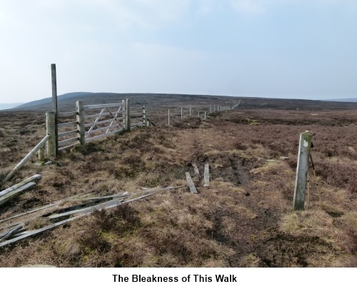
The plateau is relatively featureless and it would be easy to lose one’s
sense of direction. For that reason, I have routed this walk to make use of
fence lines as a guide. The views make it worth all the aggravation!
Start: The walk
starts just west of Dunsop Bridge on the picturesque route through the
Trough of Bowland which runs from Newton-in-Bowland to Lancaster. There is
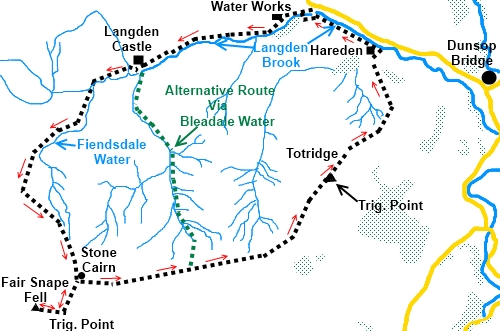
roadside parking in a rough lay-by by the entrance to waterworks (SD632512).
A sign advises - Langden No unauthorised Vehicles past this point – a
United Utilities sign.
Also, a
welcome notice at the entrance advises you that you are about to enter
Access land in the Forest of Bowland (an Area of Outstanding Natural Beauty)
and warns that it “…offers some of the roughest and most remote walking
in Lancashire…..” Quite so!
Take the
broad service track past the waterworks. At the top of a cobbled section,
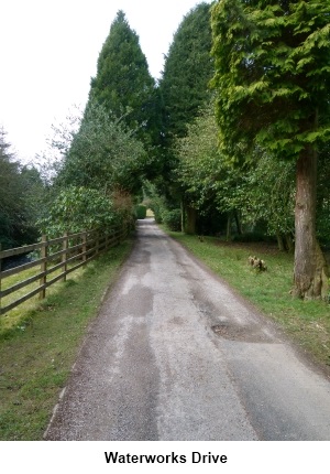
the track forks. Take the left hand fork. You soon come to Langden Castle. I
suspect the name is a result of someone’s sarcasm long ago as this is a
shooting lodge but has unusually “posh” arched stone windows. They and
the door are now well secured with steel security doors.
Shortly after
the “castle” turn left off the broad track on to a footpath indicated
with a finger post
(SD 605503) and follow the path over a series of boardwalks. As the
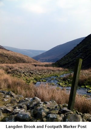
boardwalks end, the path is indicated by a series of wooden posts which bend
gently to the left to a stream (Fiendsdale Water/Langden Brook). Cross the
stream and follow the line of the posts up the hillside.
The path
gently climbs the hill above the Fiendsdale Water valley and exits on to the
plateau (SD 589485). Ahead is a fence
line and a ladder stile. Ignore the stile and turn left (South East) keeping
the fence line on your right for nearly a mile. At a gate and stile, cross
the stile continuing to follow the fence. A sign on the other side of the
gate indicates you have crossed land of Special Scientific Interest.
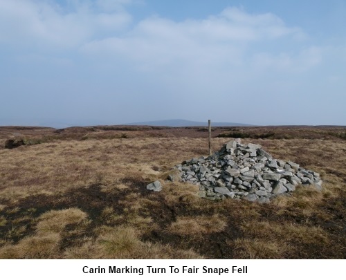
A couple of
hundred yards beyond the gate is a stone cairn (SD 597472). Remember this
cairn as you return to this after visiting the trig. point at Fair Snape
Fell.
Just beyond
the cairn on the right is a kissing gate. Go through this gate and follow
the obvious track to another kissing gate. A sign advise you are entering
Wolf Fell. Through this gate, follow a fence line to your left. As it does a
right angle turn left, slightly to the right on the near horizon is a large
stone cairn. Head for it but before you do, note the kissing gate in the
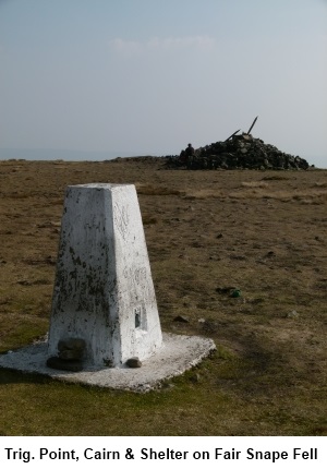
fence slightly down the hill. Do not be confused and mistakenly take this
gate on your return. The white painted trig point will appear shortly
immediately behind the cairn (SD
591468). There is a crude stone shelter also. There are excellent views from
here, especially across to Pendle Hill although my walk was blighted by heat
haze.
From the
trig. point return by the same route to the stone cairn at SD 597472
mentioned in the previous paragraph. Go back through the kissing gate and
turn right following the fence line once again.
An obvious
track swings away from the fence at SD 608473) but ignore it. This path is
the one which runs by Bleadale Water back to Langden Castle (shown as the
green alternative route on the sketch map) which might be useful should you
need to curtail the walk.
You need to
follow the fence line for approximately 1.5 miles, passing (but ignoring) a
kissing gate with a sign Welcome to Saddle Access Area. The track you want
to Totridge turns left at SD 624475 but spotting its start is not easy.
Essentially, follow the same fence line until your way is barred by another.
There are a couple of stiles here and just beyond the crossing fence, a
rough stone grouse butt. Do not go over either of these stiles but turn left
at this fence line and follow it as closely as the terrain allows. The path
alongside the fence will soon become clearer.
Eventually,
the path veers away from the fence to meet the (collapsed) corner of two
walls and continues in the same direction with the wall on the right and
reaches the trig. point on Totridge (SD
635487).
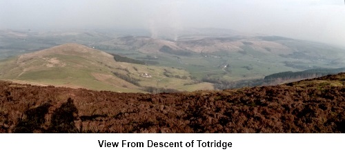
From the
trig. point, follow the narrow descending footpath marked by the occasional
small stone cairn. At a robust wooden post, turn right. There are fabulous
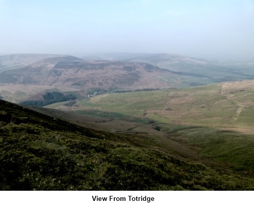
views here across the Forest of Bowland.
The path
meanders to a stone wall. Follow this steeply down the hill. As the wall
ends the path swings left to cross a fence at a stile with a
“concessionary route” footpath arrow. Follow the fence line then wall
down and as it starts to climb, to the left at the top of the field is a
farm gate with a stile alongside (and another large post indicating the
footpath). Cross this and turn left.
Follow the
broad grassy track and gradually bear right towards a copse of trees and
descend to Hareden Farm. Turn
right at the farm (note the 1790 date over the door) then left after
crossing the bridge over Hareden Brook. Walk down the farm drive looking out
for a stile on the left. Cross this, then a small bridge over the brook once
more. Cross another stile in the corner of the field then walk along the
south bank of Langden Brook back to the waterworks and the start point for
the walk.
If you need to buy any hiking
equipment/clothing before your trip see the Hiking
Store
All information on this
site is given in good faith and no liability is accepted in respect of any
damage, loss or injury which might result from acting on it.
|


.jpg)
.jpg)
.jpg)